Are you curious to pinpoint exactly where 30A Florida is located on a map? Well, you’re in for a treat! This coastal paradise, often referred to as Florida’s Scenic Highway 30A, is a must-visit destination for any traveler seeking sun-soaked beaches and charming beachfront communities.
Let’s begin our virtual journey to locate 30A Florida on a map. Picture Florida, the Sunshine State, in the southeastern region of the United States. It’s famed for its stunning coastline and countless tourist destinations, including the magical world of Disney and the bustling city of Miami. But nestled within the panhandle of this diverse state is where you’ll find the jewel known as 30A Florida.
Big Picture
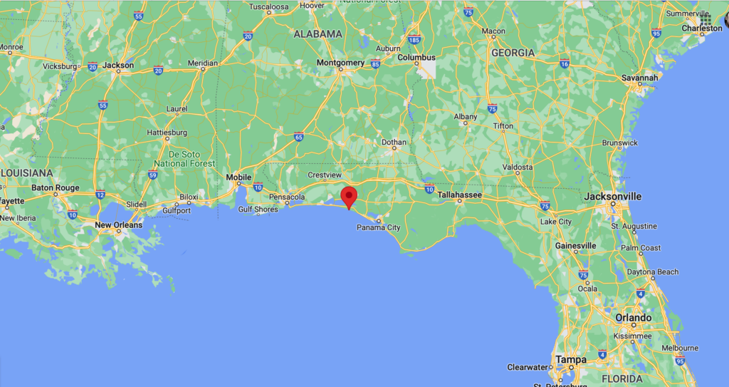
First, orient yourself to Florida’s panhandle, the broad expanse of land that stretches west from the peninsula, kissing the Gulf of Mexico’s warm, inviting waters. This region is known for its beautiful beaches, quaint towns, and diverse outdoor activities. Now, focus your attention on the southern edge of this panhandle region.
Panhandle View
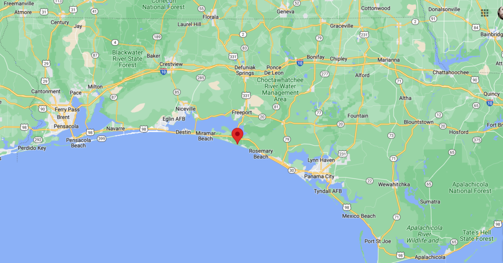
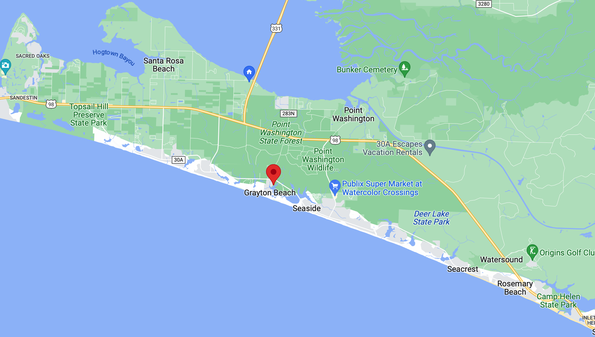
30A Florida is located in South Walton County, precisely along County Road 30A. To pinpoint it on a map, look for the area between Destin and Panama City. This picturesque 24-mile corridor hugs the coastline, boasting pristine beaches, rare coastal dune lakes, and distinctive beach towns each with their own unique flavor.
Santa Rosa Beach
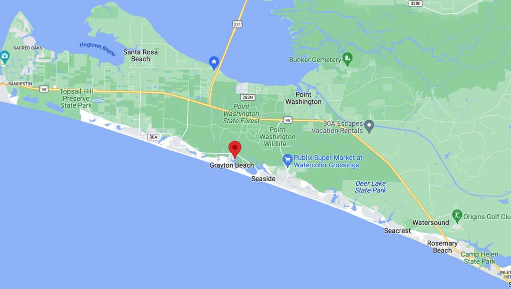
If you’re looking at a detailed map of Florida, start from the city of Destin, which is in the northwest. Travel east along the coastline, and you’ll pass through Miramar Beach, leading you to the start of Scenic Highway 30A at Dune Allen. Continue eastward, and you’ll traverse through a series of charming beach towns including Santa Rosa Beach, Grayton Beach, Seaside, and Rosemary Beach, to name a few. The road concludes at Inlet Beach, right before the city of Panama City Beach.
If you’re having trouble finding these small towns on a basic map, don’t fret. Just look for Destin and Panama City. 30A Florida is nestled comfortably in the space between these two popular destinations.
Where does 30A Start?
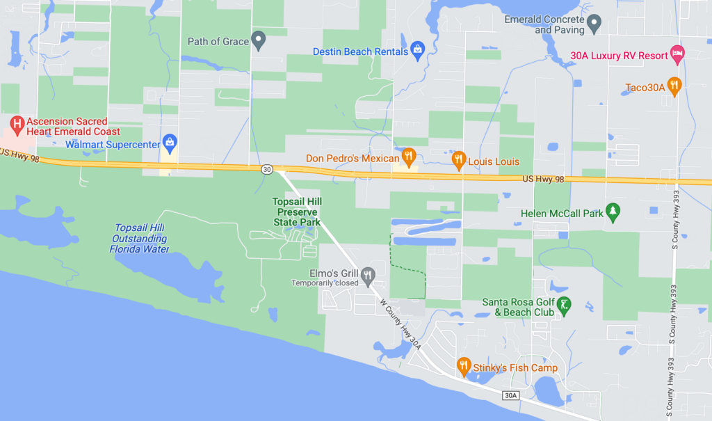
On the Western end, 30A begins on US Hwy 98 just east of Walmart in Santa Rosa Beach. It travels southeast before continuing parallel to Hwy 98. Construction is currently underway north of Hwy 98 at the intersection, and Hwy 98 is currently being widened in this area.
Where does 30A End?
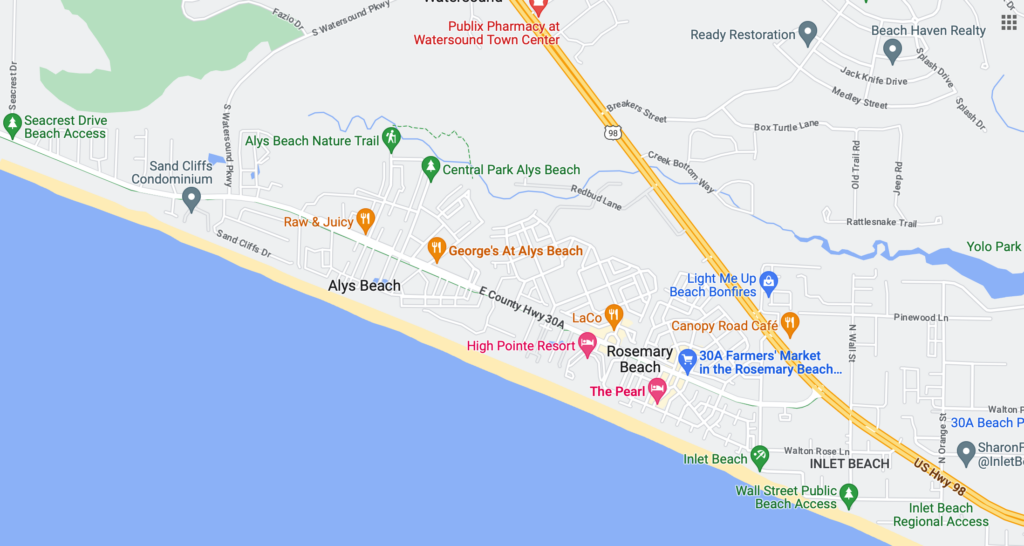
On the eastern end, 30A reconnects with US Hwy 98 between Rosemary Beach and Inlet Beach. Amazing construction is currently underway at the intersection to create an under street walking tunnel so that visitors and residents north of Hwy 98 will be able to safely cross the busy highway to reach the beach and beachside restaurants.
Finding 30A Florida on a map is just the start of your adventure. Once you’ve located this hidden gem, you’ll likely be drawn to explore what this scenic highway has to offer. From the award-winning beaches of Grayton Beach State Park to the picturesque streets of Seaside, a town so charming it was the primary filming location for the movie ‘The Truman Show,’ the 30A corridor promises unforgettable experiences.
So, now that you’ve discovered where 30A Florida is on a map, are you ready to book a rental, pack your bags, and set off on a journey? Whether you’re a beach lover, a foodie, or a nature enthusiast, the communities along Florida’s Scenic Highway 30A are sure to captivate your heart.
Remember, every great adventure starts with knowing where you’re headed. Now that you’ve pinpointed 30A Florida on the map, you’re one step closer to basking in the unique charm and natural beauty that this picturesque coastal paradise has to offer. Keep exploring, and let the call of 30A’s sun, sand, and surf guide you to your next unforgettable journey.